Author: Rob

  • Acklins and Great Inagua

    Acklins and Great Inagua

    We have come to enjoy, even cherish, night sailing. Nearly all our sails in the Bahamas have been at night, out of necessity. Arriving at anchorages usually requires visual piloting, someone standing on the bow keeping a lookout for hazardous coral heads and shoals. We sail at night so daytime arrivals will be when sun is overhead for good visibility across the water. 

    Night sailing imposes lightly focused calm on a busy, scattered mind. On a nighttime watch, minutes pass slowly, but hours pass quickly. I spent my first few night watches counting minutes and staring obsessively at the navigation instruments. That’s tedious. Forget the clock. Scan the horizon every five or ten minutes. Check the sails and glance at the instruments occasionally. That’s all there is. Wind and waves move you along as you sit there, doing mostly nothing, in endless openness and peace. 

    Until you hear a clank. It’s unmistakable. I hear it. So does Joe, even though he was sleeping off watch. It’s the sound of a small piece of metal hardware falling onto the fiberglass hardtop over the cockpit. It must have come from somewhere in the rigging up above. Is it a mission critical piece that holds the mast up? Are we facing imminent disaster? 

    I grab the flashlight and scramble up to the foredeck. I find the piece right away, a small stainless steel clevis pin with its head sheared off. It’s too small to be one of the critical pieces that hold the rigging together. It must have come from one of the slides that hold the mainsail to the mast track. Yes, that’s it. Important but not urgent. Nothing is going to collapse. It can be repaired with a twine lashing when we get to the next anchorage.

    Now try returning to peaceful watch mode. 

    A noise in the night: broken pin

    This is what they mean when people who don’t like sailing describe it as hours of boredom punctuated by moments of terror. 

    Acklins

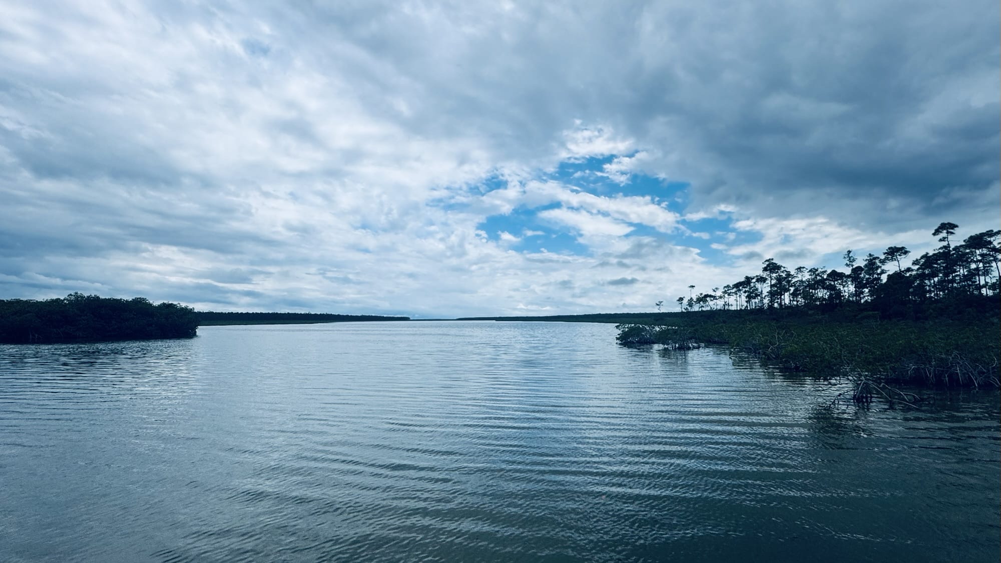
    I’ve been looking forward to Acklins Island for a long time. It’s an out island in the southern Bahamas. Really out. There are a few tiny settlements but mostly nothing at all. Acklins and its neighbor, Crooked Island, form a large, shallow bight of nearly a hundred square miles. We only spent a day there. I would happily have spent a whole season there. 

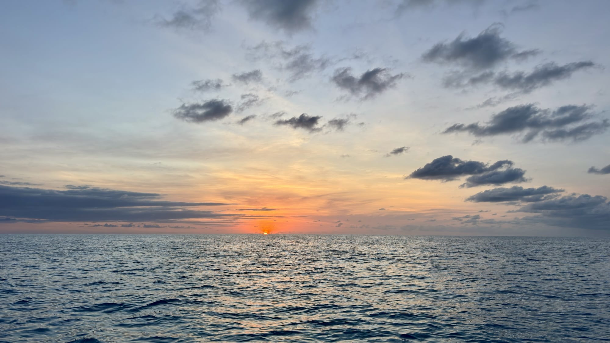
    Sunrise at Acklins

    Great Inagua

    We were eager to get on to Great Inagua, the southernmost island in the Bahamas. Although it’s the third largest of the Bahamian Islands, it feels like an outback outpost. There’s only one town, Matthew Town, and one company, Morton Salt. No one we talked to knew for sure how many people live in Matthew Town. Some said as many as a thousand. It felt like much less. A reliable source said 110 people work for Morton. Everyone else works to support them, or for the government. It’s very much a company town. 

    Matthew Town

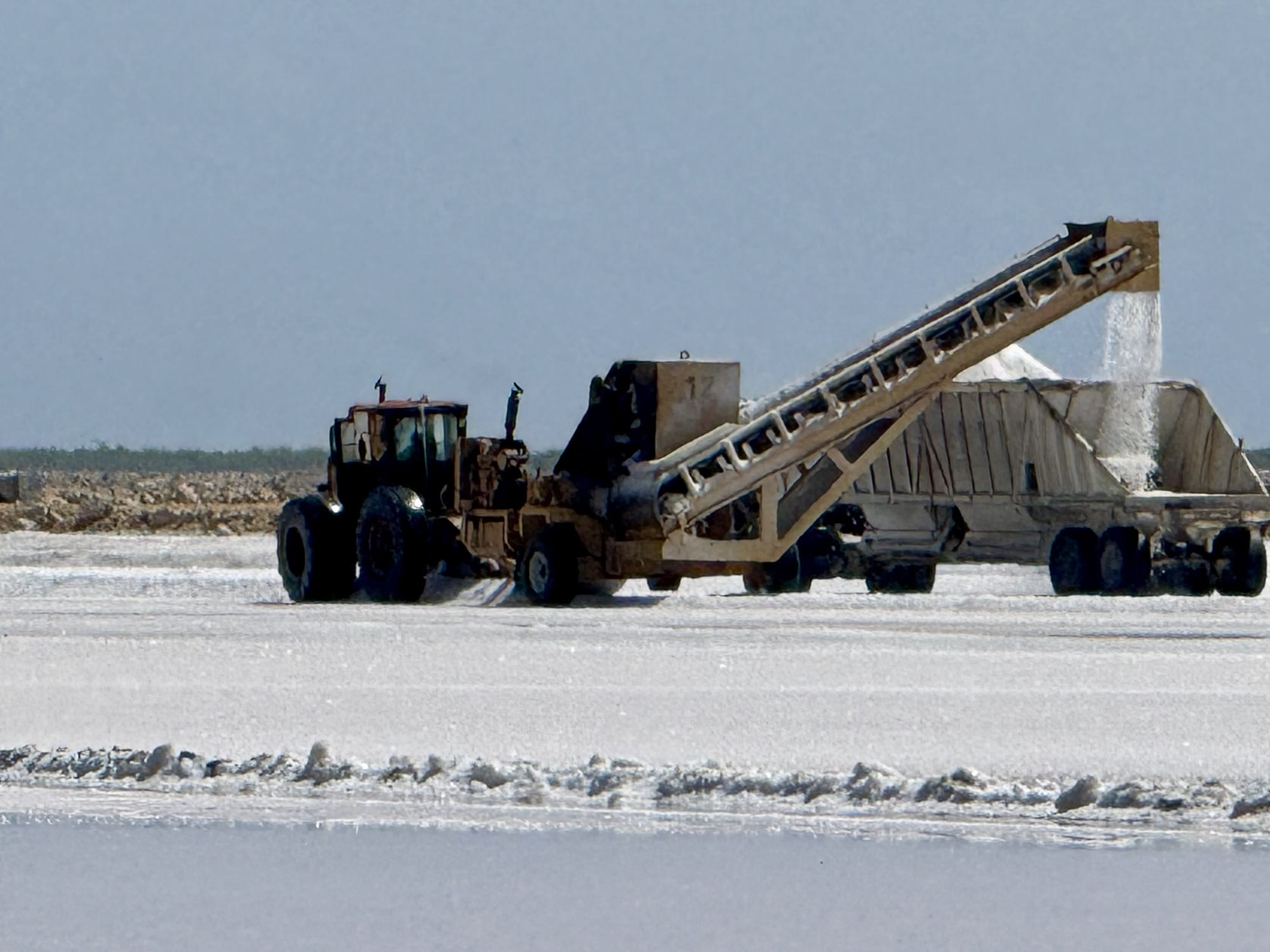
    Morton produces rock salt here, the stuff northerners spread on their roads and walkways in the winter. Seawater is pumped into large, shallow reservoirs. Water evaporates off over many months leaving a thick deposit of salt. When it’s time to harvest the salt, a giant grader scrapes salt into windrows. Another machine augurs the salt into an open hopper on a truck. Huge piles of salt wait at a dock to get augured onto ships.

    There are birds everywhere, including flamingos, the national bird of The Bahamas. Inagua is home to the largest nesting colony of West Indies pink flamingoes, ten of thousands of them. 

    Photography is difficult. It’s windy, and the air is thick with salt dust. Everything, including the camera lens, gets dirty fast.

    Potcakes

    We can’t leave the Bahamas without mentioning potcakes, the mixed breed dogs running around everywhere in settlements throughout the Bahamas.

    Bahamian potcakes

    The name comes from a traditional Bahamian dish, rice and peas. The peas are actually pigeon peas, a small bean that looks a bit like a small chickpea. In the old days, when Bahamians relied on subsistence farming, the rugged pigeon pea was one of the few crops that could grow successfully in adverse island conditions. Preparing rices and peas typically leaves a crust of burnt rice on the bottom of the pot. This pot cake was fed to the dogs.

    Clearing Out

    We went to the Customs office to formally clear out of The Bahamas. Officials here have been incredibly friendly, efficient, and helpful. The critical piece of paper for us is the zarpe (Spanish for ‘set sail’). It’s the document cruisers get when clearing out of a country. It must be presented when we check in to the next country. With a stamped zarpe in hand, we headed back to the boat to complete preparations for the passage to Panama.
  • Long Island

    Long Island

    We set sail from Cat Island to Long Island using the WindPilot, a mechanical self-steering system. This clever system steers the boat without electrical power. A blade in the air reads wind direction. A paddle in the water amplifies the wind signal into sufficient force to turn the rudder.

    Joe was on watch. I was sleeping. Suddenly Joe was shouting something about the steering not working. I was sleeping so soundly that it took me a few moments to realize I was on a boat, at sea, with something wrong. Not a fun reality to wake up to.

    I always wear a harness when leaving the cockpit, and the harness is always tethered to a jackline, part of a web of ropes placed strategically around the boat. Crew moving around outside the cockpit always have two tethers clipped to their harness. At least one of the tethers is always clipped to a jackline. One tether is clipped in a new location before the previous tether is unclipped. The idea is to have a system that makes it all but impossible for crew to fall overboard.

    Offshore sailing fashion: inflatable lifejacket/harness with tether.

    So I clipped in to a jackline and went back to the stern where I found the rudder post flopping around uselessly. The linkage to the WindPilot steering system was gone. The culprit was a missing nut. This is the same nut that I spent half an hour trying to remove a year ago in the boatyard with no luck. I gave up, figuring if it was seized this much, it would never come off. Wrong! A few months of vibration and sea spray did the trick. The ocean has a way of punishing shortcuts.

    Anyway, it was easy to disengage the Windpilot and switch over to the hydraulic autopilot. This is why we have multiple steering systems! Later at anchor I rummaged through my store of spares and found a replacement for the nut—an odd metric size. This is why we carry a seemingly ridiculous amount of spares.

    Tropical Island Skills, Part I

    Somehow, after all our years in the Keys, Joe and I never learned how to prepare fresh coconut. A Bahamian we met on the street on Cat Island gave us a pair of coconuts and a lesson on what to do with them. Joe used a big rock at the beach to smash off the outer shell. I used a knife to crack open the inner nut. We scooped out the flesh, peeled off the skin, grated it. We made ourselves a great supply of fresh coconut that turned into a loaf of Bahamian coconut bread and several breakfasts of pineapple coconut baked oatmeal.

    fresh coconut

    Long Island

    We crossed the Tropic of Cancer overnight on the way from Cat Island. For the first time on our trip we were actually farther south than where we started in Key West. We arrived early in the morning at Clarence Town on the south side of Long Island.

    The harbor is stunningly beautiful, with the classic Bahamas blues in the water, rocks and reefs to the east, and an open view to the sunset on the west.

    Father Jerome built two churches in Clarence Town, both perched prominently on a hill overlooking the water.

    Father Jerome’s striking Catholic church
    And his equally impressive Anglican church

    Tropical Island Skills, Part II

    Many have heard the story of our first attempt to land a fish in the Bahamas ten years ago. It didn’t go well for the fish or for us. I was better prepared this time with a gaff hook and a bucket.

    This is low-tech fishing, meat fishing for cruisers looking for a good meal. It’s a simple handline wrapped around a plastic spool called a Cuban yo-yo. The line is tied to the stern of the boat. On the other end, a simple cedar plug lure. An elastic snubber helps set the hook and alerts us to a fish on.

    We had been trolling with this setup for days with no luck. We hooked many wads of sargassum seaweed but nothing else. I was ready to give up for the day so I started winding the line around the yo-yo. I noticed a bunch of birds hovering over the water and remembered what the Keys fishermen say, go where the birds are. Just then I felt a bite. It was an easy retrieval with the gaff hook, though it made a bloody mess at the stern. We caught a beautiful yellowfin tuna, just the right size, enough to feed us well for two nights.

    Simple handline on a Cuban yo-yo
    We’re fishermen now!
  • Cat Island

    Cat Island

    We found no cats here. Cat Island was named after Arthur Catt, a seventeenth century buccaneer who is said to have buried his looted treasure on the island. The first permanent settlers, in the 1780s, were Crown loyalists fleeing the American revolution.

    Father Jerome

    The most famous historical figure in these parts is John Hawes, known locally as Father Jerome. Born in England in 1876, Hawes was an accomplished architect before becoming an Anglican minister. The Archbishop sent Hawes to the Bahamas to rebuild hurricane damaged churches. He later converted to Catholicism and, as Father Jerome, dedicated himself to following St. Francis of Assisi. Father Jerome spent his last years as a hermit near the settlement of New Bight.

    New Bight

    We arrived at New Bight, on the south end of Cat Island, after an overnight sail from Eleuthera. The harbor is huge and gorgeous, with a white sand beach and a row of about a dozen colorful little beachside restaurants and bars.

    The Hermitage

    Our exploration ashore started with a hike up Mt. Alvernia, the highest peak in the Bahamas. From the local government office at the beach we walked along a paved road which became a stone path past a small herd of goats. A scramble over stones led to the peak, a whopping 207 feet above sea level.

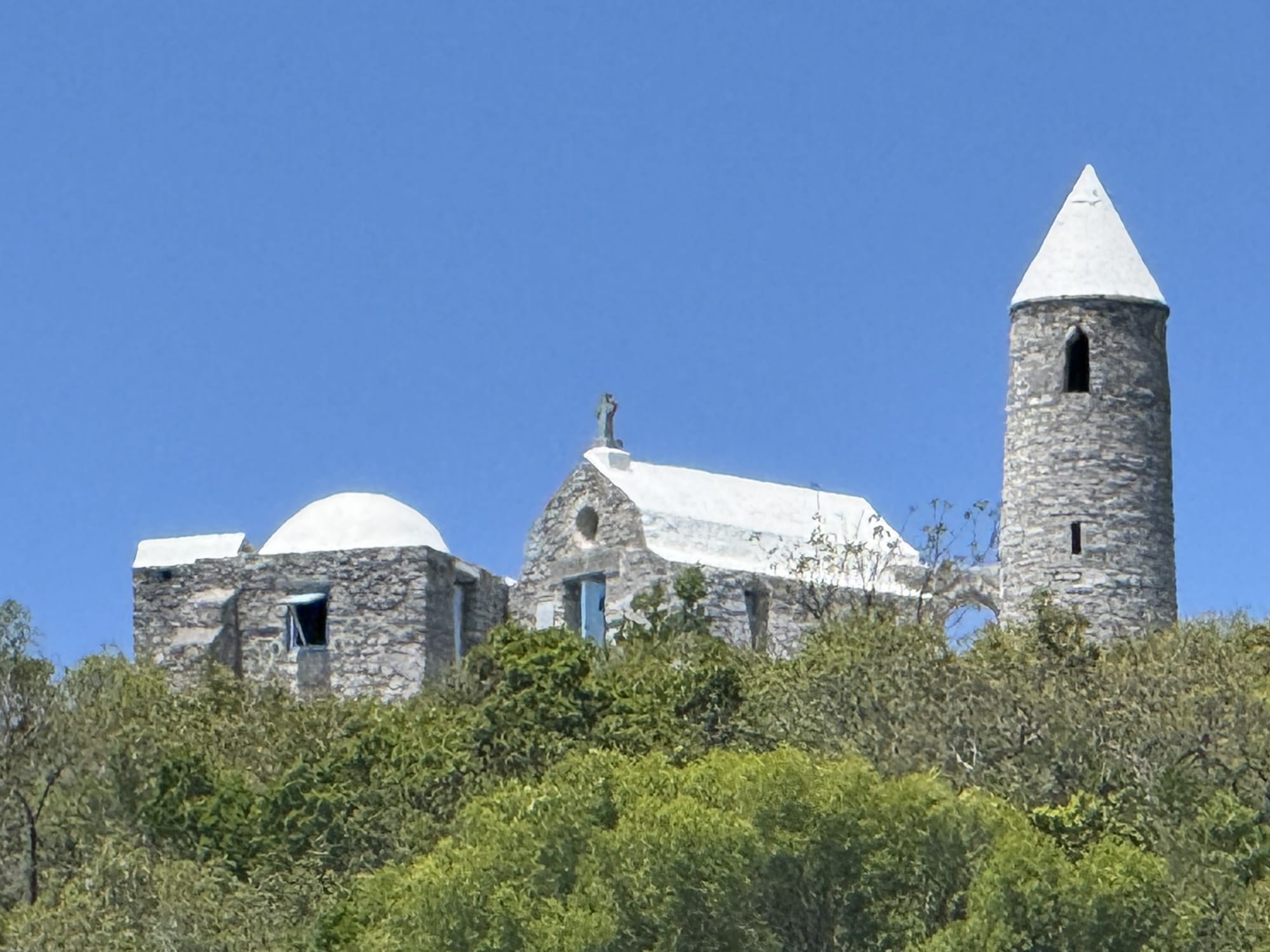
    This is where Father Jerome built a hermitage for his retirement. The stone structure is small yet stately with a stunning view over the harbor and inland forests.

    Goats guarding the path to the peak
    Steps leading to the hermitage at the peak, with stations of the cross carved in stone along the way
    At the peak of Mt. Alvernia, Father Jerome spent his final years in this remote, serene hermitage

    Not Much Happening

    Returning to the settlement, we found the beachside restaurants all closed. The only open business we found was a laundromat, a very nice one indeed—an exciting find for cruisers! Joe retrieved a bag of laundry from the boat. The proprietor told us few people come to this part of Cat Island. She was born on Cat Island, moved to Nassau as a teen with her mother, but returned as an adult hoping to find the idyllic place she remembered from childhood. She found instead a moribund economy with too little traffic to sustain businesses. The cute little restaurants on the beach open only for special occasions. The population is dwindling. It was perhaps a mistake to return, she admitted.

    Main road through the settlement. It’s easy to imagine little beachside restaurants bustling with tourists enjoying cracked conch and live music. We saw no one and heard only the waves on the beach.

    Friendly People

    Despite the lack of activity, we found the area charming. In a land known for friendly people, the few people we encountered on Cat Island went out of their way to be welcoming, friendly, and helpful.

    We had the large bay to ourselves and enjoyed the most peaceful days yet on our journey.

  • Eleuthera

    Eleuthera

    We had hoped to leave Andros on May 14 to take advantage of southerly winds for a sail east to Eleuthera, but numerous squalls kept us in place. We set sail under clear skies on Thursday, May 15 with prevailing easterly winds for what turned out to be a surprisingly pleasant thirty hour upwind sail across the northern tip of the Tongue of the Ocean, past Nassau, to the western tip of Eleuthera. Winds were mild to moderate and on our nose the entire time.

    On Autopilot

    Sailing upwind would normally mean tedious hand steering, but this time was different, thanks to our newly commissioned autopilot. This is the first time we’ve ever had a functional autopilot on one of our boats, and wow did it make a difference!

    With the boat steering itself, we could keep an attentive but leisurely watch without being stuck at the helm. It’s like having a third crew member on board–crew who doesn’t get tired, eats no food, and doesn’t complain.

    Autopilot control. Bottom number is the desired compass heading. Top number is the heading maintained by the autopilot—always an exact match.

    “I am very happy and a little annoyed to say that the autopilot steers better than I do.”

    – Joe

    Arriving at Eleuthera

    After sailing all night and into the morning, we arrived back onto the Great Bahama Bank from the Northeast Providence Channel. Depths dropped quickly from nearly 2000 feet to less than thirty. Waters transitioned from deep indigo to a soft Caribbean blue.

    Eleuthera has a long and rich history. The name comes from a Greek word meaning “free.” The first European settlers were a group of Puritans who called themselves the Eleutheran Adventurers. They were expelled from Bermuda for refusing to swear loyalty to the Crown. They hoped to form a free, self-governing society on their new island, but few survived the harsh conditions.

    Eleuthera is a narrow island forming an arc more than a hundred miles long with small settlements scattered along the way.

    Current Settlement

    Our first stop was Current Settlement, a small, peaceful village at the end of the road on the northwest side of the island. A few upscale homes and a pristine beach bordered our gorgeous anchorage.

    We took a Sunday morning stroll through the town, listening to the congregation singing hymns in a little church as we walked by. It felt like perfect, peaceful island life.

    Current Settlement, simple and charming
    the library
    We met up with Joe’s great niece Megan, her boyfriend Tim, and their friends Mariska and Mike.
    ferry to Current Island
    Current Cut. As the name implies, current whips through here. We timed our transit for slack current, as is best practice in cuts throughout the Bahamas.

    Governors Harbor

    An overnight sail took us across the Bight of Eleuthera to Governors Harbor, the first capital of The Bahamas. It’s a picturesque anchorage with beautiful old homes on a hill rising away from the harbor.

    Windhorse anchored in the harbor
    Anglican Church
    In the church yard, an adorable little meditation garden lined with conch shells.
    Library
    Methodist church, on a hill next to the harbor. Sound carries well in the harbor; we enjoyed a beautiful evening choir practice from the boat.

    Streets in town are lined with brightly flowering bougainvillea, oleander, and royal poinciana.

    One of many old homes on the hill overlooking the harbor

    An unexpected treat was a walk through the trails of the Leon Levy Native Plant Preserve just outside of town. This is a large and beautifully maintained park on a hill. Trails cut through a variety of habitats, with signs explaining the features of each.

    Aquatic habitat at the Native Plant Preserve

    Rock Sound

    A day sail took us twenty miles south to Rock Sound, near the southern tip of Eleuthera. This is a perfect anchorage—large, with good holding, easy dinghy access to town, and protection from every wind angle. Cruisers get excited about these things! There is room for a hundred boats here, but there were only three other boats when we arrived.

    Rock Sound is smaller and quieter than Governors Harbor, but somehow has the best grocery store we’ve found yet on an out island in the Bahamas. Another thing that cruisers get excited about!

    Rock Sound Harbor
    A mile walk to the grocery store. A collapsible wagon makes it so much easier to get groceries back to the dinghy.
    Hardware store and gas station

    Moving On

    We spent a week on Eleuthera, and would happily have spent a whole season. Although cruisers are admonished not to keep a rigid schedule, sometimes nature imposes its own schedule. June 1 marks the beginning of hurricane season. There’s little risk of an early hurricane in the Bahamas, but our plan remains to get the boat out of the path of hurricanes. Our chosen destination is Panama, south of the hurricane zone. We have a thousand miles to go to get there. Tropical waves, low pressure systems originating in Africa, start migrating westward across the Atlantic this time of year. Some of them develop into tropical cyclones in the Caribbean. Even without forming into a hurricane, a tropical wave can make for a few days of wet, miserable sailing on our way to Panama.

  • Andros

    Andros

    Andros is the largest of the Bahamian islands but one the least known, least visited of the big islands. The interior Caribbean pine woodlands blend into grasslands along the coast and along numerous creeks cutting across the island. The poor, sparsely populated expanses feel like the frontier, a subtropical wild west. Sponging once made the island wealthy. Today, other than some sportfishing charters and a few hidden luxury resorts, there’s little economic activity.

    Our anchorage at Morgan’s Bluff

    We anchored in a semi-protected cove at Morgan’s Bluff on the northeast tip of the island. There’s not much there other than docks for the mail boats that bring provisions.

    Legend looms large here. Locals believe that the seventeenth century pirate Henry Morgan kept watch on the high bluffs outside the cove and stashed treasure in a nearby cave.

    The bluff from which Henry Morgan kept watch for Spanish ships
    And the cave where he is said to have stashed looted treasure

    A tiny but charming beachside pub caters to cruisers and locals alike. The proprietor, Kizzy, handles everything visiting cruisers need from arranging for customs and immigration clearance to renting cars.

    Clearance formalities couldn’t have been easier. An official drove from the airport ten miles away to meet Joe at a picnic table outside the dockmaster’s office. There she quickly issued our visas and cruising permit.

    The weather turned bad for a few days with unseasonably heavy rains. We spent one of the rainy days touring the island in a car rented from Kizzy. The sixty mile drive down the main road, Queen’s Highway, took us through numerous tiny settlements. Along the way we stocked up on produce at a Mennonite farm stand, visited a batik factory, and enjoyed a simple dinner prepared with love by the pastor of a local church and his wife.

    The Bahamas belonged to Britain until independence in the 1970s, so we drove on the left.

    A Mennonite produce stand in the town of San Andros
    Batik craft in the village of Fresh Creek

    A fifteen mile drive out to the west side of the island brought us to the tiny settlement of Red Bays. The settlement was established in the 1820s by escaped slaves and Seminole refugees from Florida. The isolated village was unknown and uncontacted until a century later. Today, residents are almost all descendants of the original settlers.

    There were a dozen or so cruising boats in the harbor with us. We got to know most of the cruisers over dinners of cracked conch at Kizzy’s. Everywhere, locals were friendly and helpful. Overall, we found Andros to be a great first stop for clearing in and well worthy of spending some time to explore.

  • Crossing Over

    Crossing Over

    We were really impressed with the strong sense of community in Boot Key Harbor. People were friendly and helpful. We can see why so many people keep coming back every year, or never leave. As one woman said to Joe in the laundry room, “Honey, this place has a sticky bottom. We came here for two weeks. We’ve been here fourteen years.”

    We did move on, initially to an anchorage on the west side of Boot Key with gorgeous views of the sunset over the Seven Mile Bridge.

    Sunset over the Seven Mile Bridge

    We waited a few more days for a weather window–not an ideal window–but as good as we were going to get this time of year.

    Our last view of US territory, Sombrero Key Light south of Marathon

    Dolphins and flying fish entertained us as we sailed away from the Keys and into the indigo waters of the Straits of Florida.

    The Gulf Stream

    To get to the Bahamas, you have to cross the Gulf Stream. It’s the world’s strongest ocean current, transporting warm water from the Caribbean all the way across the Atlantic to northern Europe. The current flows at speeds up to 5 knots between Florida and the Bahamas. For context, we typically motor at 5 knots for maximum fuel efficiency. At this cruising speed, the current is as strong as our engines.

    Gulf Stream current

    Our point of departure, from the Middle Keys, kept us in the Stream a long time. In the middle, where the current was strongest, steering was challenging at times.

    Aim for their stern

    The Straits are major shipping route. In addition to dealing with current, we were constantly maneuvering to avoid giant tankers and container ships.

    The Bahamas

    Why work so hard to get to the other side? You can see the allure of the Bahamas from space. Look at all the beautiful blue water!

    Satellite view of the Bahamas

    After thirty hours of mixed sailing and motoring, we came up on the Great Bahama Bank, a vast area of shallow, baby blue water with uniform depths of 12 to 15 feet. Winds collapsed in the afternoon, so we dropped a lunch hook—temporary anchor—and enjoyed a few hours of rest before continuing on for another night.

    We motored more than we wanted to on the final leg to Andros Island, but with wind on our nose we had no choice if we wanted to arrive at our anchorage in daylight. We arrived Saturday afternoon and completed check-in formalities at Morgans Bluff, a tiny harbor on the northeast tip of Andros.